Trail Difficulty: Easy | Moderate | Strenuous | Tough
Trail Head: Adevikanda, Erathna (near entrance to mini-hydro power plant)
Nearest Town: Erathna Nearest City: Kuruwita
Access to Trail head:
Route to Adevikanda, Erathna
|
 |
Colombo -> Awissawella -> Ehaliyagoda -> Kuruwita Town [80km] -> Erathna[11km] -> Adevikanda[3km] (approximately 94km)
Roads are paved all the way up to the trail head from the Kuruwita town on A4 Highway. Public transport is available from Kuruwita to the trail head during the Sri Pada season. Off season this will be limited to the Erathna town. Account for 40 mins from Kuruwita if driving and 1.5 hours on public transport.
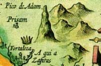
Trail End: Sripada (Adam's peak) Total Length: 12km
Elevation Gain: 1850m (Elevation at Trail Head: 400m | Elevation at Trail End: 2250m)
Approximate time: 8 – 12 hours
Hiking Season: Official Sri Pada season begins in December and ends in April. This is the period of best weather. Avoid long week-ends and full-moon days during this period unless you enjoy a crowded trailJ.
An off-season climb can also be extremely rewarding since you will completely be away from any civilization or human contact until you reach the peak. Select a dry moth, July or August, since the trail can be extremely hazardous to pass during monsoon months.
Permit Required: NO
Kuruwita – Erathna trail to Sri Pada is the third most popular trail leading to Adam's peak. This trail is much difficult to tackle than the most popular Hatton-Nallathanni route.
While this trail is about 3km longer than the second most popular Rathnapura – Palabathgala route, the trail conditions and the surrounding environment is very much similar to the Palabathgala trail. In fact these two trails meet 2km before the summit.
0 to 3.4km: The first 3.4km of this trail is mostly an intense continuous climb. There will be brief flat or less intense sections, but they rarely last for more than 100m at a stretch. This section of the trail mostly goes through the disturbed forest and abandoned tea fields and therefore the trail is fairly broad and open. Steps and other forms of support is available only at most difficult point. The rest of the trail is a rough track over boulders and rocks for the most part.
This climb ends at the top of a mountain known as "Warnagala" meaning "The colourful rock". "Warnagala" possibly got its name because of the large, exposed rock bed on its side. A stream flows over the large rock bed creating a beautiful large waterfall called "Warnagala falls". Unfortunately at present most of the water have been diverted to generate hydro power and therefore the true beauty of the fall can only be seen during the wet months (off season).
Important land marks you will pass during this stretch would be
- "Jambolagaha-Yata" Ambalama (A Permanent Rest Place) at 1.6km from trail head (Waypoint: ES06)
- "Diamondgala" ambalama (A Permanent Rest Place) at 2.6km from the trail head (Waypoint: ES11)
- The intake basin of the penstock of the power plant (where the large pipes carrying water to the turbines collect water diverted from the stream) at 2.8km from the trail head (Waypoint: ES12)
- "Saman Dewalaya" & Buddha Statue about 50m from ES12 (Waypoint: ES13).
An important land mark (and an attraction) that should not be missed in this section is the "Warnagala Falls". The first glimpse of the waterfall (or the exposed rock bed during the dry season) can be seen high up in the mountain at round 1.2km from the trail head (Waypoint: ES04). As you climb, around 2.2km from the trail head, the trail goes over the side of this rock bed (Waypoint: ES04). There is a small bridge like structure and steel bars on the trail to help climb the rock bed. After passing the small bridge look for a trial on to your right side through the forest. This trail will take you to the large rock bed of the waterfall (Waypoint: ES10) (less than 100m walk). Even during the dry season, there are several large pools filled with crystal clear water and during rainy season you can see the magnificent cascade of water over the large rock bed.
This continuous climb ends as you reach the top of Warnagala Mountain, 3.4km from the trail head.
3.4 to 6 km: As you reach the top of Warnagala Mountain, after passing a scenic outlook where the trail goes over a rock bed with iron bar laid for support (Waypoint: ES16), you will see the trail transforming in to a narrow foot path through dense, undisturbed forest. These 2.6km is an easy and interesting walk along the edge of a cliff with a river flowing deep in the valley. Because of the forest canopy the trail is well shaded from the sun, the forest is full of interesting wonders such as little flowers and streams, and the trail is more or less flat (with only occasional, very brief climb ups and downs).
The only "Ambalama" or permanent rest place you find in this section is the Ambalama at "Seethagangula" or "Icy River" (Waypoint: ES22). At the point, which is located exactly 5km from the trail head; the trail meets the river that was flowing in the valley, at a point where two streams merge. There is a beautiful large natural pool with crystal clear water. You can bath in the river if you can handle the temperature!
As you walk about 1km from this point you will again have to start a section of continuous climb (Waypoint: ES24).
6km to 10km: You will experience frequent, intense climbs during this section as you make about a 500m elevation gain. There will be flat sections intermittently but they will not last long. The trail still goes through the dense forest for the most part and very irregular. Underfoot conditions are not smooth at all.
At about 7.7km from the trail head you will reach Buddhist shrine and a small temple called "Medahinna Temple" (Waypoint: ES28)
At about 9km from the trail head, you will reach a somewhat flat area with a large bed rock and a permanent resting place (Waypoint: ES32). This is called the "Idikatupana" or "GeththamPana". As the trail goes over this bed rock, take a look behind you. You will see an interesting landscape with a prominent square shape mountain in the backdrop seen over layers of trees. If you happen to be at this place in the late evening you will be able to witness a memorable sunset scene. There are few places in this section of the trail where you find this square spare mountain creating interesting compositions, the sunset scene at this place is the best out of all of them in my opinion.
Passing this point as you climb another 1km along the rough trail, you will reach the resting place called "Galwangediya" where the Rathnapura-Palabathgala Trail meets the Kuruwita – Erathna Trail, 10 km from the trail head (Waypoint: ES33)
10Km to 12km: There are few resting places in the next 100m from ES33. The last of this bunch situated at 100m from Galwangediya (Waypoint: ES34). This entire area is a high altitude plain and it's called "Haramitipana". From "Heramitipana" Adam's peak rising like a pinnacle from the surrounding peaks can clearly be seen making it clear that from this location it is a single continues climb to the summit.
Passing "Haramitipana Plain" you have to tackle a somewhat intense and continuous climb on an irregular rocky trail for about 1.2km to reach the last permanent resting place before the summit which is called "Adiyamalathenna" (Waypoint: ES35)
From this point the steepest ascend of the trail has to be tacked. This section is called "Mahagiridamba" or "The Great Rock Climb". This entire 800m of length is a steep climb. The last 600m is so steep that the steps are continuously aided with steel bars on both sides. As you reach the summit it feels more like walking in the Sky as the steps are so steep.
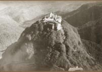
12km from the trail head you reach the summit of Sri Pada which is the 5th highest and the most prominent peak in Sri Lanka (Waypoint: ES38).
Tips, Notes & special remarks
- The summit can be extremely windy & cold, be prepared if you plan to stay there for a considerable time.
- Except during the late months of Sripada season, the probability of rain is quite high. (Thunder storms during monsoon months May – July, Sep – Nov). Be prepared with a rain coat and water proofing for electronics such as cameras.
- Leaches may occasionally bother you, especially in the lower sections of the trail.
- Small shops pop up on the way to the mountain top offering all sorts of food and refreshments during Sripada season.
- Drinking Water is plentiful. Water from streams is generally safe to drink without treatment.
- Make it a point to be at summit before sunrise to witness how the distinctive shape of the mountain casts a triangular shadow on the surrounding plain.
- The best approach would be to start from the trial head on a late morning, reach “Galwangediya” or "Heramitipana" by the evening, spend the night there and climb up to the summit before the sunrise.
- The sheltered rest spots or "Ambalamas" are suitable for an overnight stay if required. During Sripada season, the trail is lit-up at night.
Way Points
|
|
N: dd° mm.mmm’ |
E: dd° mm.mmm’ |
Elevation |
|
ES01 |
6° 50.004‘ |
80° 25.623‘ |
386 m |
|
ES02 |
6° 49.971‘ |
80° 25.917‘ |
454 m |
|
ES03 |
6° 49.919‘ |
80° 26.134‘ |
542 m |
|
ES04 |
6° 49.899‘ |
80° 26.226‘ |
595 m |
|
ES05 |
6° 49.894v |
80° 26.318‘ |
622 m |
|
ES06 (Jambolagaha-yata) |
6° 49.869‘ |
80° 26.387‘ |
624 m |
|
ES07 |
6° 49.837‘ |
80° 26.450‘ |
657 m |
|
ES08 |
6° 49.779‘ |
80° 26.523‘ |
686 m |
|
ES09 |
6° 49.698‘ |
80° 26.551‘ |
720 m |
|
ES10 (Warnagala Falls) |
6° 49.670‘ |
80° 26.534‘ |
728 m |
|
ES11 (Diamondgala) |
6° 49.651‘ |
80° 26.613‘ |
768 m |
|
ES12 |
6° 49.607‘ |
80° 26.707‘ |
824 m |
|
ES13 |
6° 49.582‘ |
80° 26.717‘ |
840 m |
|
ES14 |
6° 49.593‘ |
80° 26.790‘ |
894 m |
|
ES15 (Warnagala) |
6° 49.581‘ |
80° 26.944‘ |
1000 m |
|
ES16 |
6° 49.548‘ |
80° 26.958‘ |
1012 m |
|
ES17 |
6° 49.495‘ |
80° 27.099‘ |
1067 m |
|
ES18 |
6° 49.571‘ |
80° 27.235‘ |
1070 m |
|
ES19 |
6° 49.546‘ |
80° 27.274‘ |
1067 m |
|
ES20 |
6° 49.495‘ |
80° 27.305‘ |
1069 m |
|
ES21 |
6° 49.404‘ |
80° 27.398‘ |
1063 m |
|
ES22 (Seethagangula) |
6° 49.343‘ |
80° 27.464‘ |
1051 m |
|
ES23 |
6° 49.303‘ |
80° 27.568‘ |
1079 m |
|
ES24 |
6° 49.132‘ |
80° 28.014‘ |
1186 m |
|
ES25 |
6° 49.169‘ |
80° 28.071‘ |
1218 m |
|
ES26 |
6° 49.064‘ |
80° 28.319‘ |
1294 m |
|
ES27 |
6° 49.016‘ |
80° 28.341‘ |
1304 m |
|
ES28 (Medahinna) |
6° 48.948‘ |
80° 28.435‘ |
1324 m |
|
ES29 |
6° 49.013‘ |
80° 28.517‘ |
1345 m |
|
ES30 |
6° 48.939‘ |
80° 28.617‘ |
1397 m |
|
ES31 |
6° 48.860‘ |
80° 28.771‘ |
1433 m |
|
ES32 (Geththampana) |
6° 48.792‘ |
80° 28.845‘ |
1478 m |
|
ES33 (Galwangediya) |
6° 48.620‘ |
80° 29.225‘ |
1681 m |
|
ES34 (End of Haramitipana) |
6° 48.634‘ |
80° 29.293‘ |
1697 m |
|
ES35 (Adiyamalathenna) |
6° 48.671‘ |
80° 29.687‘ |
1958 m |
|
ES36 |
6° 48.590‘ |
80° 29.784‘ |
2017 m |
|
ES37 (Ehela-Kanuwa) |
6° 48.557‘ |
80° 29.866‘ |
2094 m |
|
ES38 (Summit) |
6° 48.554‘ |
80° 29.963‘ |
2233 m |
Courtesy: www.lakdasun.com